Zoning Classifications
Understanding Zoning Codes
Zoning is the framework behind how cities grow, neighborhoods evolve, and land is used, but the complexity of zoning classifications, codes, and maps often makes it difficult to navigate. In this guide, April Dinger, and the Research Team demystify the zoning landscape, breaking down the different types of zoning districts, how to read zoning maps, and the terminology professionals need to know. Whether you're analyzing a site for development, assessing investment risk, or ensuring regulatory compliance, this is a practical resource for understanding how zoning influences real-world decisions.
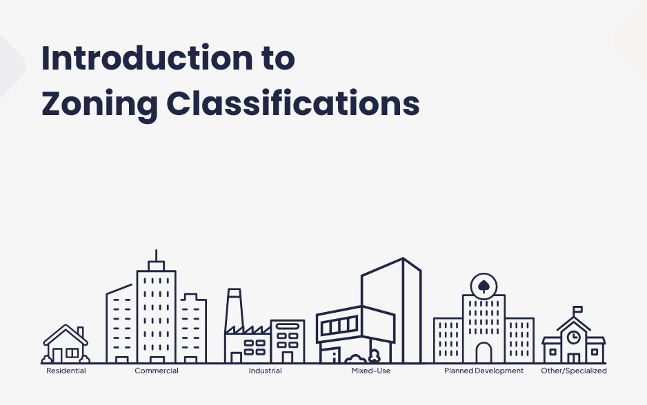
Introduction to Zoning Classifications
Zoning classifications are the foundation of land use planning. They define what types of buildings and activities can take place in different areas of a community, helping to separate conflicting uses while promoting organized growth. While zoning categories generally fall into broad groups like residential, commercial, industrial, and mixed-use, every municipality has its specific classifications, labels, and zoning codes. Some cities may use traditional zoning categories, while others incorporate more flexible or customized zoning approaches.
Below are the most common types of zoning classifications and what they typically regulate:
Residential Zoning
Residential zoning districts regulate housing types, densities, and neighborhood design. The specifics vary widely from one community to another, but common residential zones include:
- Single-Family Residential (R-1, R-2, etc.)
Limits development to detached homes on individual lots. Higher-numbered districts (R-2, R-3) may allow slightly denser configurations like duplexes or townhomes.
- Multi-Family Residential (RM, R-MF, etc.)
Permits higher-density housing such as apartment buildings, condominiums, and townhouses. Some areas specify different density levels (low-rise vs. high-rise apartments).
- Rural or Agricultural Residential (RA, A-1, etc.)
Designed for low-density housing, often on large lots with space for farming or livestock.
- Manufactured Home Parks (MH, MHP, etc.)
Designates areas for mobile home communities, with regulations on lot size, spacing, and amenities.
Commercial Zoning
Commercial zoning districts regulate businesses, retail centers, and office developments. Some common classifications include:
- Neighborhood Commercial (C-1, NC, etc.)
Small-scale businesses like coffee shops, convenience stores, and salons serve local residents.
- General Commercial (C-2, GC, etc.)
Larger shopping centers, restaurants, and service businesses attract customers from a broader area.
- Central Business District (CBD, CB, etc.)
Typically found in downtown areas, this zoning allows for high-density commercial and office buildings, sometimes mixed with residential uses.
- Office/Professional (O, OP, etc.)
Designated for office buildings, medical clinics, and professional services rather than retail stores.
- Highway or Regional Commercial (HC, RC, etc.)
Intended for larger businesses that rely on highway access, such as big-box retailers, hotels, and auto dealerships
Industrial Zoning
Industrial zoning controls where manufacturing, warehousing, and heavy commercial activities can take place. These zones help prevent industrial operations from conflicting with residential or commercial areas. Common types include:
- Light Industrial (LI, IL, M-1, etc.)
Allows for smaller-scale manufacturing, research facilities, assembly plants, and warehousing that produce minimal noise or pollution.
- Heavy Industrial (HI, IH, M-2, etc.)
Permits large-scale manufacturing, chemical processing, refineries, and other intensive industries that may generate noise, pollution, or heavy truck traffic.
- Industrial Park (IP, PID, etc.)
A planned district for multiple industrial businesses, often with specific design and infrastructure requirements.
Mixed-Use Zoning
Mixed-use zoning allows a blend of residential, commercial, and sometimes industrial uses within the same district. These zones encourage walkability and vibrant, multi-purpose neighborhoods. Common types include:
- Traditional Mixed-Use (MU-1, MX, etc.)
Integrates housing, offices, and retail into a single area, often in urban settings.
- Live-Work Zoning (LW, MU-LW, etc.)
Designed for small businesses or artists who live in the same space where they work.
- Transit-Oriented Development (TOD)
Encourages dense, mixed-use development near public transit hubs to reduce car dependence.
Planned Development Zoning (PD, PUD, etc.)
Planned development zoning provides flexibility by allowing a mix of uses tailored to a specific project. Instead of following rigid zoning categories, a developer proposes a custom land use plan that is reviewed and approved by the local government. These districts are often used for:
- Large Residential Subdivisions
Master-planned communities with a mix of housing types, parks, and amenities.
- Commercial or Industrial Campuses
Business parks, shopping centers, or technology hubs with coordinated design and infrastructure.
- Resort or Entertainment Districts
Tourist-focused developments with hotels, theme parks, or casinos that require unique zoning considerations.
Other Specialized Zoning Categories
Some municipalities create additional zoning districts to address unique needs, such as:
- Historic Preservation Zoning (HP, HPO, etc.)
Restricts changes to buildings in designated historic districts to maintain architectural character.
- Conservation or Open Space Zoning (OS, CO, etc.)
Protects environmentally sensitive areas, wetlands, or public parks from development.
- Institutional Zoning (IN, P-I, etc.)
Regulates schools, hospitals, government buildings, and religious institutions.
- Floating Zones
A zoning designation that doesn’t apply to a specific area until a developer applies for and receives approval to use it.
Zoning Codes and Variability Across Municipalities
While these classifications are common, every city and town has its zoning code with unique designations, abbreviations, and regulations. Some municipalities use letter-and-number combinations (e.g., R-1 for single-family residential), while others use descriptive names (e.g., “Low-Density Residential”). Additionally, zoning rules can change over time to reflect community goals, economic trends, and environmental concerns.
Understanding zoning classifications is essential for homeowners, business owners, and developers alike. Whether you’re buying property, starting a business, or planning a project, knowing how land is zoned can help you navigate local regulations and make informed decisions about land use.
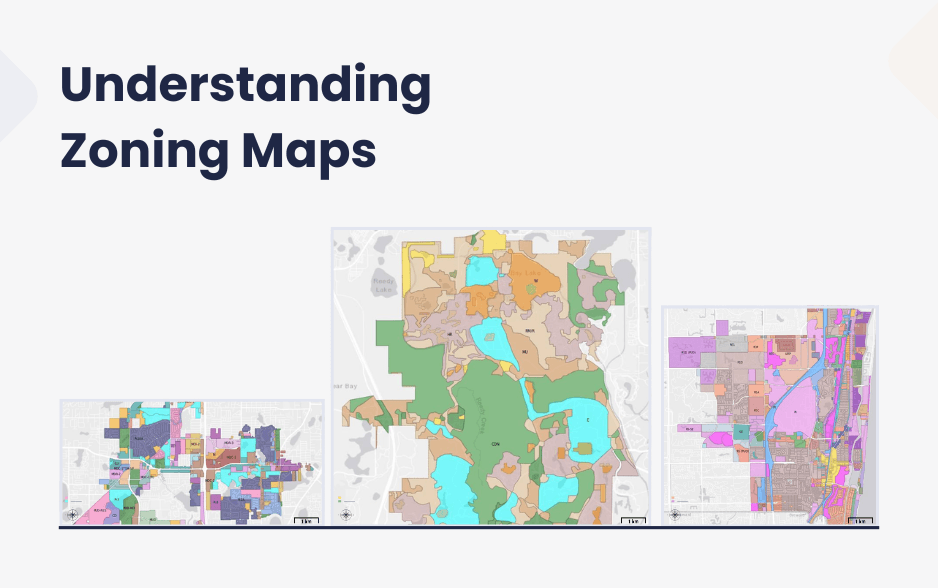
Zoning maps and how to read them
A zoning map is a visual representation of how land is divided into different zoning districts within a municipality. It serves as a key tool for planners, developers, and residents to understand land use regulations in a given area. While zoning codes define what can be built and how properties can be used, the zoning map shows exactly where those rules apply.
Understanding the Basics of a Zoning Map
Zoning maps are typically color-coded and overlaid on a city or county map. Each color or pattern represents a specific zoning district, such as residential, commercial, industrial, or mixed-use. Alongside the map, a zoning legend explains what each color or abbreviation means.
Most zoning maps include:
- Zoning Districts
Each area on the map is labeled with a zoning classification (e.g., R-1 for single-family residential, C-2 for general commercial).
- Property Boundaries
Thin lines indicate individual property lots, helping identify which zoning district a specific parcel belongs to.
- Roadways and Landmarks
Major roads, highways, parks, and water bodies are included for reference.
- Overlay Districts
Some maps show additional zoning layers, such as historic preservation areas, flood zones, or special development districts.
- Scale and Orientation
A scale bar and compass rose help determine distances and directions on the map.
How to Read a Zoning Map
- Find the Legend
The legend (or key) explains the zoning classifications and their corresponding colors or patterns. It may also include symbols for special zoning overlays or restrictions.
- Locate the Property
Identify the address or parcel number you’re interested in and see which zoning district it falls under.
- Check Adjacent Zoning
Understanding nearby zoning districts can provide insight into potential future development, business opportunities, or conflicts (e.g., if a new commercial area is planned near a residential neighborhood).
- Look for Overlay Zones
Some areas may have additional regulations, such as historic preservation, environmental protections, or transit-oriented development zones.
- Cross-Reference the Zoning Code
Once you know the zoning designation, refer to the municipality’s zoning code to understand the specific regulations for that district, such as height limits, land use restrictions, and required setbacks.
Where to Find Zoning Maps
Zoning maps are typically available online through a city or county’s planning or zoning department website. Many municipalities provide interactive GIS (Geographic Information System) maps that allow users to search by address, view multiple zoning layers, and access additional property details. Printed zoning maps may also be available at local government offices.
Why Zoning Maps Matter
Zoning maps are essential for:
- Property Owners
Understanding what can be built or modified on a lot.
- Business Owners
Determining where certain types of businesses can operate.
- Developers and Investors
Identifying potential sites for new projects and understanding zoning restrictions.
- Community Members
Staying informed about how neighborhoods are planned and evolving.
Zoning maps are more than just planning tools—they shape the growth and character of a community. Knowing how to read and interpret them is an important step in understanding local land use regulations and making informed decisions about property and development.
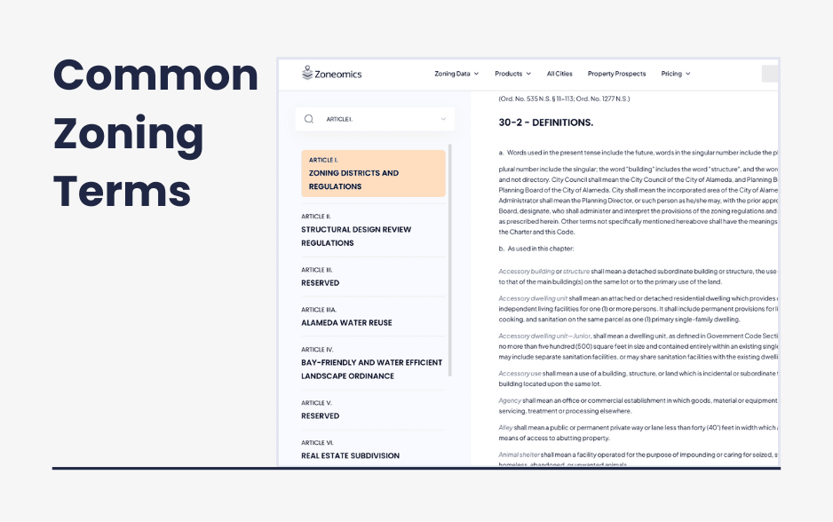
Common zoning terms and definitions
Common Zoning Terms and Regulations
Understanding zoning terminology is essential for navigating land use regulations, whether you’re a homeowner, business owner, developer, or community member. Below is a list of commonly used zoning terms, organized alphabetically, along with explanations of why they matter.
⸻
Common Zoning Terms
- Accessory Dwelling Unit (ADU)
A secondary housing unit on a single-family lot, such as a basement apartment, garage conversion, or backyard cottage.
Why it matters: ADUs provide affordable housing options and increase housing density without drastically changing neighborhood character.
- Building Height Limit
The maximum height a structure can be built is usually measured in feet or stories.
Why it matters: Controls the scale of development and maintains neighborhood aesthetics, privacy, and sunlight access.
- Buffer Zone
A designated area that separates different land uses, such as a strip of trees between a residential neighborhood and a commercial district.
Why it matters: Reduces conflicts between land uses, enhances privacy, and improves environmental quality.
- Conditional Use Permit (CUP)
A permit allowing a land use that is not typically permitted in a zoning district but may be approved under certain conditions.
Why it matters: Provides flexibility for uses that may benefit a community but require additional review (e.g., daycare centers in residential areas).
- Density
The number of housing units or structures allowed per acre of land.
Why it matters: Regulates how densely an area can be developed, influencing affordability, infrastructure needs, and neighborhood character.
- Easement
A legal right allowing someone to use another person’s property for a specific purpose, such as utility access or a shared driveway.
Why it matters: Ensures essential infrastructure access and prevents disputes over land use rights.
- Floor Area Ratio (FAR)
The ratio of a building’s total floor area to the size of its lot.
Why it matters: Controls building mass and density, influencing urban design and land use efficiency.
- Historic Preservation District
A zoning designation that protects buildings or areas of historical significance by limiting modifications.
Why it matters: Helps maintain cultural and architectural heritage while guiding redevelopment.
- Inclusionary Zoning
A policy requiring or incentivizing developers to include affordable housing units in new residential projects.
Why it matters: Encourages housing affordability and socio-economic diversity.
- Mixed-Use Development
A zoning category that allows residential, commercial, and sometimes industrial uses in the same area.
Why it matters: Promotes walkability, reduces traffic congestion, and creates vibrant, multi-functional communities.
- Nonconforming Use
A land use or structure that was legally established under previous zoning laws but no longer complies with current regulations.
Why it matters: Determines whether older properties can continue operating as they are or need to be modified over time.
- Overlay District
A zoning layer that adds additional regulations on top of existing zoning designations, such as flood zones or transit-oriented districts.
Why it matters: Allows municipalities to address specific concerns, such as environmental protection or urban development, without rewriting entire zoning codes.
- Planned Unit Development (PUD)
A zoning category that allows for flexible, master-planned developments combining various land uses (e.g., residential, commercial, parks).
Why it matters: Encourages creative, large-scale projects that might not fit within traditional zoning categories.
- Setback
The required minimum distance between a building and a property line, street, or neighboring structure.
Why it matters: Ensures proper spacing between buildings for safety, aesthetics, and access.
- Spot Zoning
When a single property or small area is given a different zoning classification from the surrounding land.
Why it matters: It can be controversial if it appears to favor individual landowners over community interests.
- Variance
A special exception granted by a zoning board allowing a property owner to deviate from zoning regulations.
Why it matters: Provides flexibility for property owners while ensuring zoning laws are not overly restrictive.
- Zoning Ordinance
The set of laws and regulations that govern land use and development in a municipality.
Why it matters: Serves as the legal framework for zoning enforcement and community planning.
What’s Next?
Feel free to reach out if you have specific questions—or if you’re curious how Zoneomics can help your team work more efficiently with easy access to zoning data. We’d love to connect
📍 Book a Demo
📜 Explore Our Platform
✉️ Contact Us